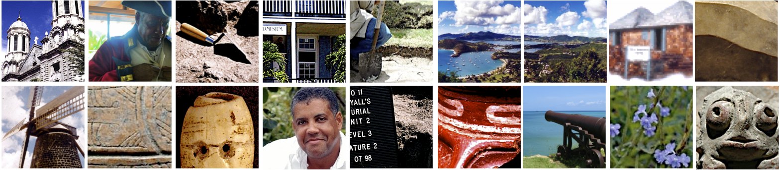
Sites
Preserving our sites and heritage!
Reg, I thought we could do something like this only specific to Antigua...
Winthrope's Bay
Archaic Age and Ceramic Age
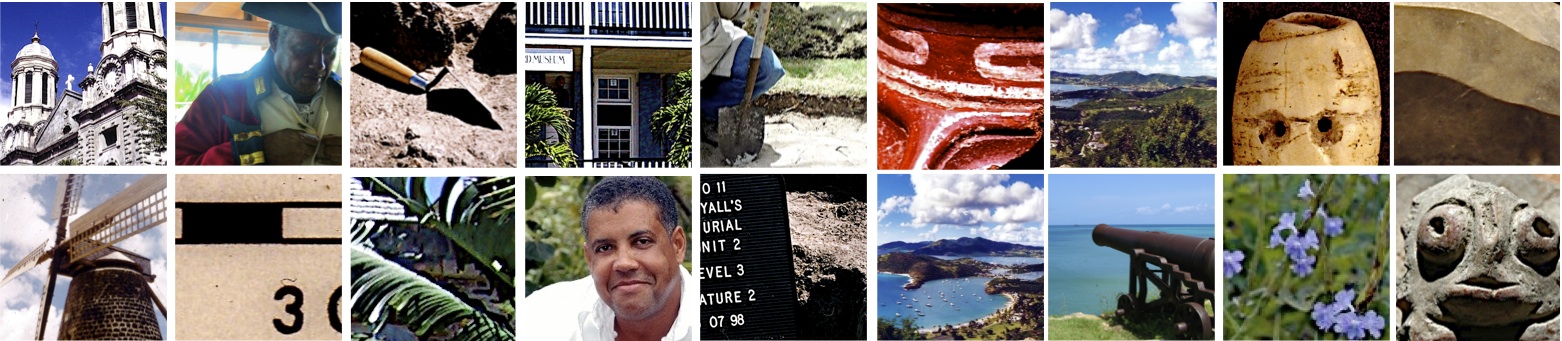
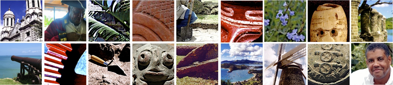
Winthorpe's Bay has had a long and interesting history. It is the area on Antigua closest to Long Island and its flint resources, and some of the largest reefs and mangrove systems on Antigua. Winthorpe's Bay was heavily utilised by pre-Columbian peoples from the days of initial settlement. Along the entire waterfront, for several kilometers, are scatterings of Archaic Age flakes and lithic debitage, in association with deposits of shellfish, the remains of ancient meals.
An archaeological survey was conducted along the coastline in 1997. During this survey, three Ceramic Age sites were noted and investigated. GE-06 (Winthorpe's West), yielded Saladoid pottery one meter below the surface. The site however, is primarily a post-Saladoid site. The second and largest site, GE-01 is a large munti-component site (Winthorpe's East), post Saladoid and Archaic. A lithic workshop, or flint processing area was discovered here. Archaeological excavations were conducted in 1997 and 2002. The results will comprise a report, the Archaeology of Winthorpe's Bay.
Winthorpe's Bay carries the name of the historical Winthorpe's family of New England, USA. Their sugar estates were eventually purchased by the Nibbs family. Their tombstones can still be observed. During the Second World War, the area was ceded to the United States military, and an Air Base established. Although little evidence remains of this period, earthern embankments (or revetments) build to protect the airplanes, can still be found in the bush. Much of the area remains the property of the US Airforce. However, recent land development (summer 2003) has destroyed GE-01, Barnacle Point, and the Archaic sites, GE-9 and 10. Research in the area continues.
Archaic Age Sites: Winthrope's Bay; Deep Bay (1,387BC); Jolly Beach (1,775 BC); Twenty Hill (2,910 BC ); Hand Point (1,317 BC); Cloverleaf (383 BC); Five Island Gap (71 BC).
Post Saladoid Sites: Coconut Hall | Mill Reef | Muddy Bay | Winthorpes West
Royall's
Archaeological research at the Saladoid site of Royall's on Antigua, has greatly expanded our understanding of the pre-Columbian peoples and their intimate knowledge of the natural resources available on the island. Recently excavated finds include, hearths, ceramic vessels, a ceramic mask, and further evidence of the manufacturing of beads and pendants with locally available raw material. The latter has inspired a geological survey of the island to confirm the availability of the minerals and gemstones. Preliminary analysis of the faunal remains indicates a susbstantial exploitation of terrestirial fauna, especially of rice rates. Radiocarobon dates place habitation at Royall's between cal. AD 250-650.
The result of this study and fieldwork was beyond expectation.
Ceramic Age/Pre Columbian Sites: Cades Bay | Doigs | Elliot's | Green Castle Hill | Indian Creek | Long Island | Mill Reef | Royall's
Shirley Height's
Historical Period
With the rise of Napoleon France and increasing military tensions in Europe, British economic interests in the Caribbean were under threat of invasion.
In the 1790's a campaign was begun to strengthen the fortifications of Antigua. In light of the fact that the Naval Dockyard at English Harbour was of strategic importance to British interests, gun platforms and barracks with support facilities were constructed on the surrounding hills to house and support a large military force that could be quickly deployed in the region.
These fortifications and barracks were manned primarily by numerous British Regiments, but due to the high mortality rate among the white British troops, African (black) soldiers from the West India Regiments were stationed here at various times. All of the construction and support work at this large site was conducted by enslaved Africans.
The result of this cultural melting pot, is a rich archaeological assemblage with many avenues for theoretical and field research. Current research activities include, mapping the cemeteries and burial sites scattered across the hillsides, excavations at the artillary officers quarters, the barracks and canteen, and mapping all previously unrecorded structures.
Shirley Height's Project
Survey and excavations continues sporadically on the ridge, particularly at the Block House barracks. Recent excavations there have uncovered remains of several British regiments, including uniform buttons from the 54th West Norfolk Regiment, the 36th Herefordshire Regiment, the 68th Durham Light Infantry, the 37th North Hampshire Regiment, and the 69th South Lincolnshire Regiment. In addition, a domino piece made from lead, and a bone or ivory brush handle inscribed with the name Rodd was recovered along with a large volume of faunal remains, broken glass and china tableware fragments. The focus of this project is comparative research between the various barracks and residential spaces of the British military on the ridge at Shirley Height’s. To date only the barracks of the Artillery Officers, the soldiers’ barracks at the western Lookout and the western section of the Blockhouse have been systematically sampled, mapped and about 4 meter square units at each site excavated. At the Blockhouse midden overlooking the sea, research during restoration work uncovered a previously unknown underground drainage system that was used to collect and channel surface rain-water into the cistern.
British Fortification Sites: Fort George/Monk's Hill | Middle Ground | The Ridge at Shirley's Heights
Nelson's Dockyard Seawall Project/Underwater Archaeology
Historical Period
The focus of the archaeological recovery is to sample various sites along the seawall where different activities took place. This may provide a diverse range of artifacts and information. Funding and support is provided by the Nelson’s Dockyard National Park.
- During the 2002 June and July field season, we managed to recover over one thousand artifacts. Many of these are currently in conservation and analysis. The recovery of this large volume was due to the presence on island of numerous archaeology students, and professional divers who volunteered their time. As it was the slow season, several professionals from the English Harbour community volunteered their equipment and services.
Methodology
The primary tool being used is an airlift. This home-made device consists of a compressor, a garden hose, a 10ft length of 4 inch pvc piping and a few adaptors. As the air rises in the pipe, it expands and creates suction. All material is deposited in a series of floating screens/sieves and then sorted on land. Metal detectors are also used underwater and on land to find the small items hidden in the thick coral encrustation.
The Sea Bed
The sea bed in front of the wall has three distinctive layers. The first is a layer of fine silt that is filled with modern day garbage. It clouds the water on contact and greatly reduces visibility. The second layer is a black pasty layer that gets progressively harder with depth. This layer has many shells and ancient artifacts. The third is a sterile layer of pristine white sand in places, clay and bedrock in others.
Artifacts Recovered
Artifacts fall into two classes: accidental loss overboard, or, throw away trash. Modern artifacts include: cell phones, sunglasses, batteries, boarding ramps, bottles, worn fittings. Old artifacts represent a period between 1770 and 1890. These include, uniform buttons, musket and cannon balls, coins, bayonets and gun parts, parts of rigging, fittings, glass lenses, china, and bottles.
Conservation
Conservation is the biggest challenge that faces this project. We do not have adequately trained personnel or long term storage facilities. We cannot conserve large iron artifacts, but the small manageable ones are placed immediately in fresh water tanks and the water changed weekly. A qualified technician must be brought to Antigua. As other islands have a similar problem, I propose a hands on workshop format.
The Next Step: Where do we go from here?
Continue sampling.
Locate and train additional personnel.
Get training in conservation.
Improve storage facilities.
Speed up analysis of large items that have to be returned to the sea. (This will free storage space).
Goals for the Future
New museum exhibits.
Publications:books, booklets and papers for presentation.
Popular media documentary.
Digitize info on CD for educational purposes.Establish a project web site.